in N.I.
applications personal Android applicationNorthern Ireland's geography is still highly politicised in spite of the relative peace of recent years. Communities often show solidarity, mark their territory, and express identity through the display of flags, bunting and murals. As such, colour is an important signifier of political allegiance. The words Orange or Green when applied to a person or area take on political or social significance.
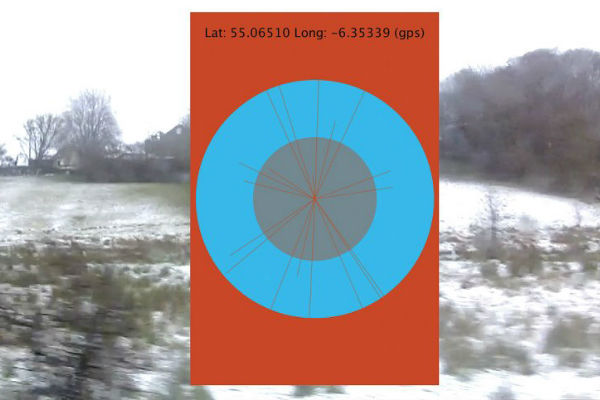
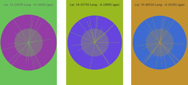
By using a strict series of gradients determined by latitude and longitude values rather than the demographics of an area, the "in N.I." app converts any given point in Northern Ireland into a new colour. This colour is joined by its contrasting colour at all times (reflecting the two communities living together).While this app is mostly about creating an objective and neutral colour map for Northern Ireland, at 124 sites across the British Isles the app will respond directly to that location's significance in the Troubles. The animation changes from slowly intersecting circles to rapidly flashing squares and the date of the incident in question appears on screen. No other details are given (about victims or group responsible, for example). It is left up to the user if they want to conduct their own search for the particular event.
Created while UK & Ireland Resident at Digital Arts Studios, Belfast.
- Java (including Processing for Android)
- Photoshop